Tracking fish habitat for a dynamic fisheries management
Identification of essential fish habitat by the JRC contributes to the establishment of fish stock recovery areas (Article 8 of the Common Fisheries Policy) and paves the way for a dynamic fisheries management and healthier fisheries sector.
Operational Mitigation of Juvenile by-catch
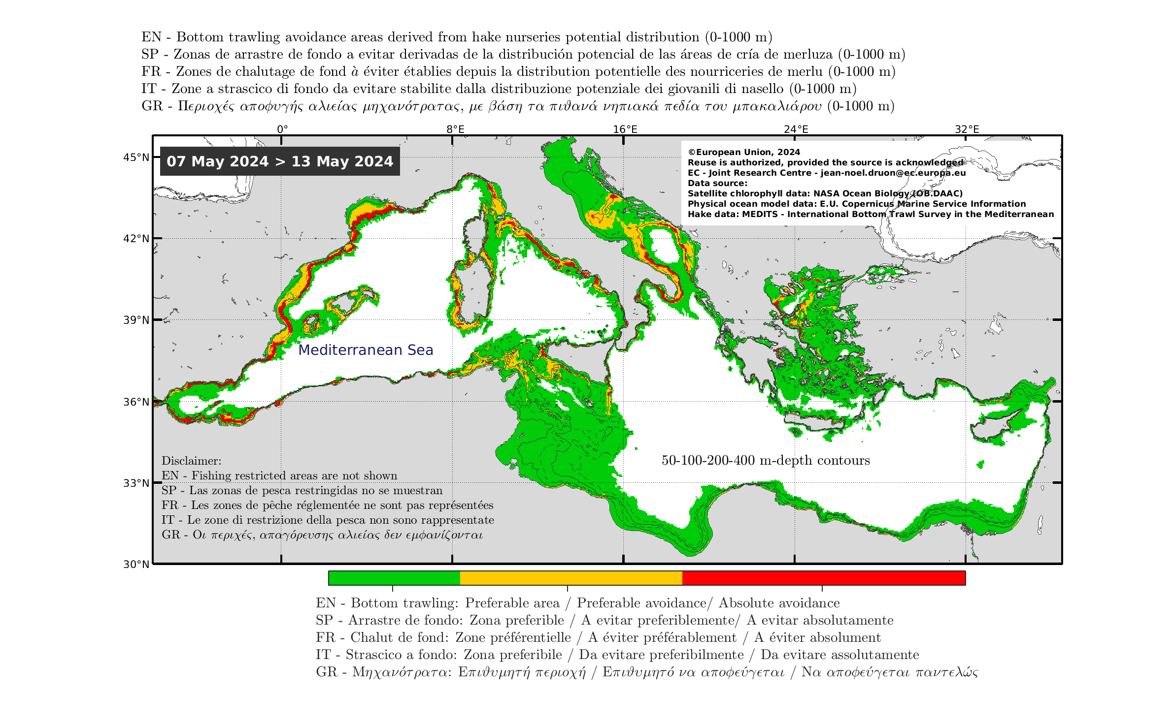
Real-time mapping of bottom trawling preferable avoidance based on habitat estimation of hake nurseries (Druon et al. 2015) (daily update at 16.00 Central European Time).
Download real-time maps: full resolution image (.png), or Google Earth (.kmz) for zooming in your area.
EN: Download presentation to MEDAC (07/06/2016).
IT: Scaricare la presentazione di Mazara del Vallo (14/10/2016).
FR: Téléchargez la présentation de Sète (13/12/2016).
FR: Téléchargez la présentation de Roses (18/07/2019).
CATALAN: Descarregar la presentacio de Roses (18/07/2019).
Send to JRC-EMIS ec [dot] europa [dot] eu (subject: Fish%20Habitat) (contact) recipient email address to daily receive the map in both formats.
Visualize animation for:
Operational by-catch mitigation of large pelagic fish
Example of by-catch mitigation product (January 2015-2018) for vulnerable blue shark life stages to fishing in the Google Earth format to facilitate the specific view of (a) the Atlantic Ocean, (b) the eastern Pacific Ocean, (d) the Indian Ocean and a more precise view on (c) Madagascar and (e) New Zealand areas.
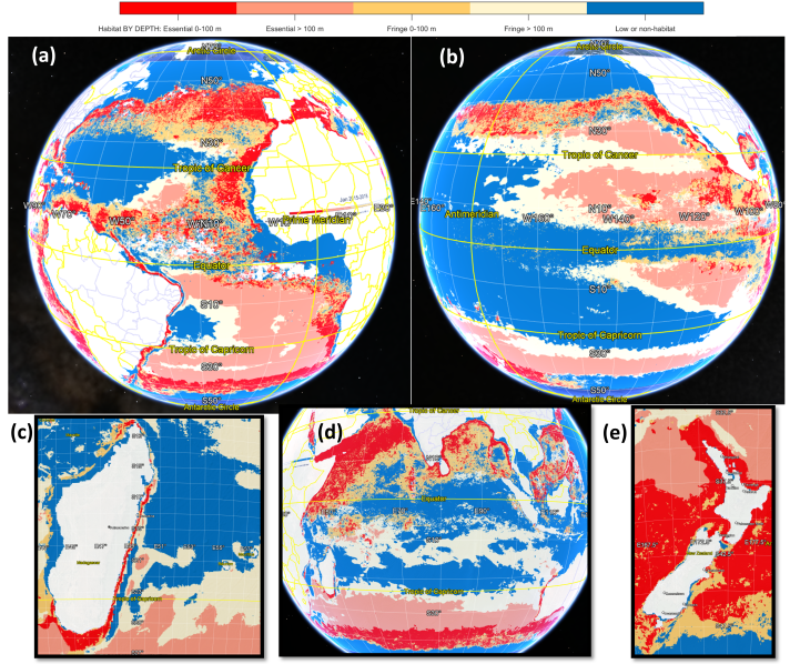
- Download the Google Earth format for August (2015-2018) (kmz, 6 MB)
- Download the Google Earth format for the twelve months (2015-2018) (72MB)
Watch and download equivalent maps separated in surface and deep mitigation product surface and deep mitigation product (twelve months 2015-2018)
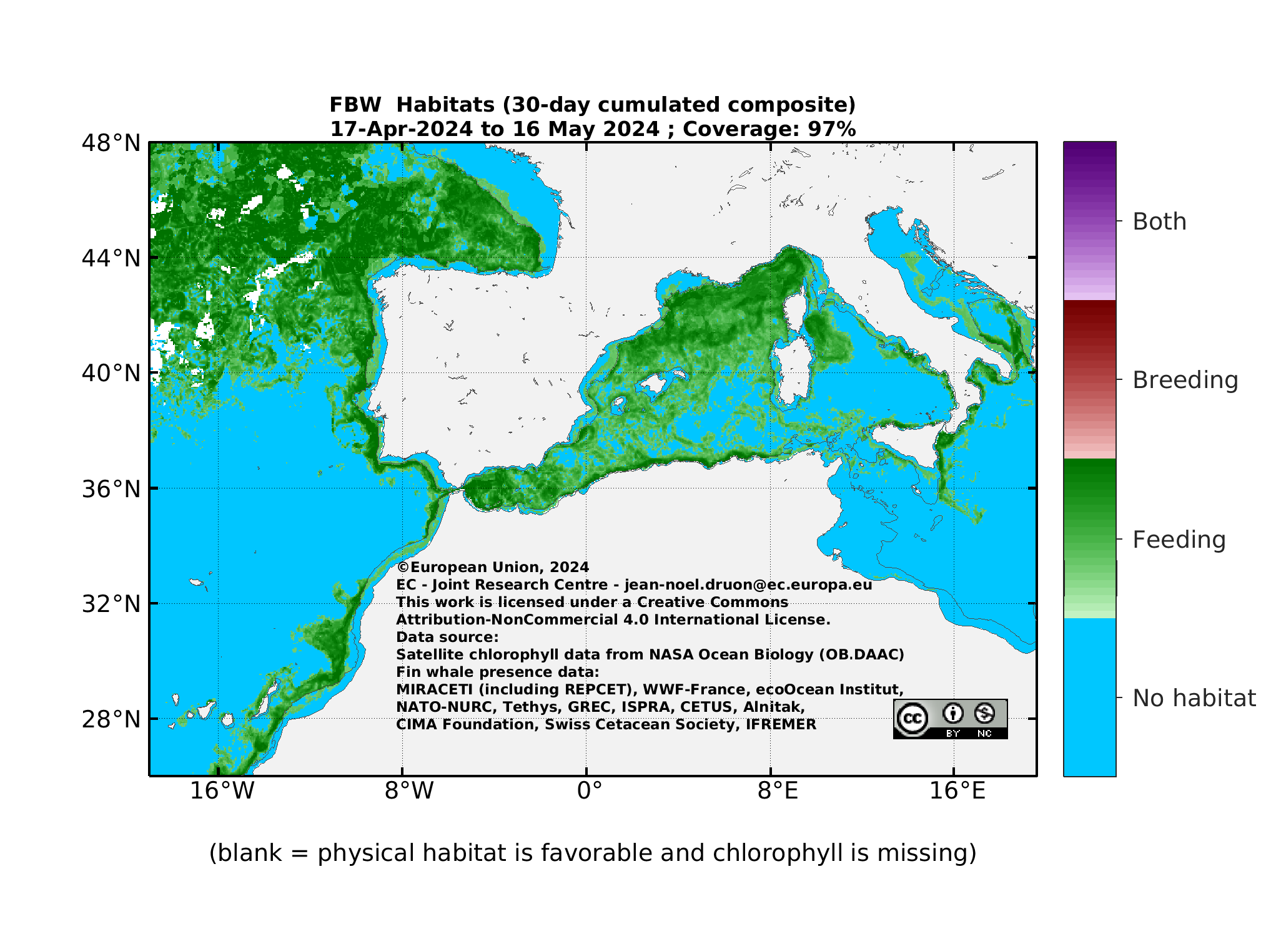
Other example of operational ecology
Potential habitat of fin whale is daily produced in near-real time (only during the summer months) and sent to a restricted list of users (below the best-performing 30-day composite habitat map, for a larger view click here):